



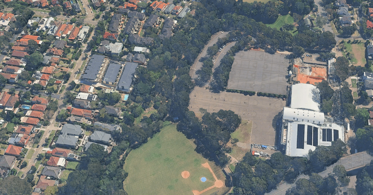
Bicentennial Reserve in Willoughby is a familiar place for sport, walking and outdoor recreation, but beneath part of its green landscape lies an old rubbish tip whose legacy continues to affect groundwater and raise concerns about aquatic life in Flat Rock Creek.
Read also:What to See at the Flat Rock Gully Walking Track in Willoughby
Ammonia from the former landfill has been found in creek water at concentrations exceeding ecological protection criteria. Although council investigations assessed the risk to people using the reserve as low, the possible effects on the creek’s environment remain under scrutiny.
A three-year monitoring programme is examining how ammonia moves through groundwater and into the creek, with the results expected to help determine whether further environmental assessment or remediation planning is needed.
The rubbish tip beneath today’s recreation area
Long before Bicentennial Reserve became a place for sport and recreation, sections of Flat Rock Gully were used for dumping and burning household and industrial waste.
Waste disposal expanded during the 1940s and continued until 1985, gradually reshaping parts of the valley. The Walter Burley Griffin-designed incinerator, built in 1934, operated until 1967, while dumping continued after its closure.
Council’s historical walking guide records that the landscaped area east of Flat Rock Drive sits above approximately 30 metres of rubbish and soil fill. The former Naremburn Waterfall, once located near Flat Rock Bridge, was also buried beneath council refuse during the 1930s.
The landfill’s effects have lasted well beyond its closure. Water passing through buried waste can collect dissolved contaminants, producing polluted liquid known as leachate. Contamination can then move into groundwater and nearby waterways.
How ammonia reached Flat Rock Creek
The NSW Environment Protection Authority (EPA) formally declared the former landfill significantly contaminated land in October 2023 after identifying ammonia pollution associated with the site.
According to the EPA, landfill leachate was entering Flat Rock Creek and had produced ammonia concentrations above ecological protection criteria. Groundwater in the underlying sandstone had also been affected, with contamination likely moving beyond the former landfill.
The regulator identified potential harm to aquatic ecosystems in Flat Rock Creek and downstream groundwater-dependent habitats, although the existence and condition of a potentially affected downstream ecosystem had not been confirmed in council’s published information.
Council’s investigation assessed the risk to people using the former landfill site as low. Its published findings also indicated that the ammonia concentrations identified were not considered a human-health concern.
Concerns about groundwater contamination emerged during council’s review of environmental information associated with the proposed Beaches Link and Gore Hill Freeway Connection. Council notified the EPA in early 2021 and subsequently commissioned further investigations.
What ammonia can mean for creek wildlife
Flat Rock Creek runs through a bushland corridor that supports wildlife across Willoughby and neighbouring areas.
Council classifies Flat Rock Gully as a Wildlife Protection Area, recognising habitat for small birds, reptiles and frogs. The reserve also forms part of a wider, non-continuous habitat connection between the Middle Harbour and Lane Cove River catchments.
Aquatic organisms face different risks from animals living in the surrounding bushland.
Ammonia occurs naturally as organic matter breaks down, but excessive concentrations can harm freshwater life. Fish and aquatic invertebrates can be affected through changes to their normal biological functions, while prolonged exposure can impair growth, reproduction or survival.
The degree of toxicity depends partly on water temperature and pH. Changes in water chemistry alter the balance between ammonia and ammonium, including the proportion present in the more toxic un-ionised form.
Australia’s freshwater-quality guidelines account for these differences when assessing potential risks to aquatic ecosystems.
However, the EPA’s finding that ammonia exceeded ecological criteria does not establish that fish, aquatic insects or other organisms in Flat Rock Creek have already been harmed. The publicly reviewed contamination records do not establish a verified loss of aquatic species in the affected creek sections.
Monitoring will determine whether further work is required
In September 2024, the EPA approved a Voluntary Management Proposal submitted by Willoughby City Council, establishing a three-year programme for monitoring ammonia in surface water and groundwater.
Sampling includes three locations along Flat Rock Creek: one upstream of the former landfill and two downstream. Three groundwater monitoring wells are also included, allowing environmental specialists to compare conditions across the site.
Testing measures ammonia alongside indicators including water temperature, pH, dissolved oxygen and electrical conductivity.
The programme is designed to identify seasonal changes, responses to weather conditions and whether ammonia concentrations are declining naturally or remaining a concern.
Council has published sampling reports covering monitoring undertaken between March 2024 and November 2025. Its assessment of the March and June 2024 results found conditions broadly consistent with earlier investigations. A verified comparison of subsequent readings is still needed to establish a longer-term trend.
The EPA-approved programme requires quarterly reporting through February 2027, with a final monitoring report scheduled for April 2027.
An ecological risk assessment would be required if the monitoring establishes, using an appropriate statistical method, that ammonia concentrations are increasing or remaining stable because of contamination migrating from the former landfill.
Further remediation planning would depend on that ecological assessment identifying unacceptable risks to Flat Rock Creek and recommending action.
No capital works are included in the first phase of the approved management proposal.
What reserve visitors need to know
For residents using Bicentennial Reserve, the contaminated-land declaration does not automatically mean the sporting grounds, walking paths or recreation facilities must close.
Council’s investigations assessed the risk to site users as low, and its contamination notices did not announce a general closure of the reserve. The current operating status of individual facilities has not been independently confirmed.
An Environmental Management Plan establishes controls for activities that could disturb buried waste or bring workers and other site users into contact with contaminated landfill material.
The plan addresses activities such as maintenance and excavation, while the separate monitoring programme focuses on ammonia in groundwater and Flat Rock Creek.
Council maintains information about the former landfill and publishes monitoring reports on its website. Residents seeking further details can contact its waste team at waste@willoughby.nsw.gov.au or 9777 1000.
The council’s Flat Rock Gully walking track information also advises visitors that sections can be slippery when wet and creek crossings may become impassable after rain.
Read also:Experience the ‘Galuwa Inyun Bulga’ Trail at Flat Rock Gully Reserve in Willoughby
The next milestone for Flat Rock Creek
The EPA-approved monitoring programme is scheduled to conclude in February 2027, followed by a final report in April.
The accumulated results will be used to assess whether ammonia contamination warrants a more detailed investigation of ecological risks. Any subsequent remediation planning will depend on the findings of that assessment.
Published 28-Oct-2026